
Fishing Maps
The difference is we provide detailed oceanographic knowledge, unique indices that help you find fish, and responsive service.
We are Oceanography for Game Fishing.
Your maps were spot on.

Nick Sheehan
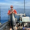
Nick with yellowfin tuna caught in the Bay of Plenty, New Zealand
That's been the hottest spot for the last 2 days.

Manuel Greenland
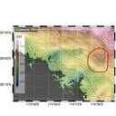
Manuel fishing off the Bay of Islands, New Zealand, with the help of my suggested area.
Spot on again Sam. I fished that break off the Cavallis this morning. Had a pack attack of striped marlin resulting in a double hook up. After that just put one lure out and hooked another one. Skippies are stacked up against it.

Paul Spooner
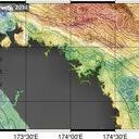
Paul was happy to see that our maps work!
I've just finished watching this [Advanced video] - thank you. Was some good information and helping to build some more pieces to this whole game fishing puzzle for me!

Michael Sudfelt
New Zealand